Welcome to US County Map
Iowa County Map
Iowa is located in the heart of the Corn Belt and is one of the leading producers of corn
Arkansas County Map
Arkansas, also known as the “Natural State,” is a state located in the South Central United States.

About Us
At US County Map, we are passionate about education and making learning resources accessible to all. Our mission is to provide free, high-quality United States County Maps that educators, students, and enthusiasts can use for educational purposes and creative projects.
We believe in the power of knowledge, and that’s why all our county maps are available for free. No subscriptions, no hidden fees—just a wealth of information at your fingertips.
New York County Map
New York City, also known as the Big Apple, is the most populous city in the United States
South Carolina County Map
South Carolina, also known as the Palmetto State, is located in the southeastern
West Virginia County Map
West Virginia, also known as the Mountain State, is a beautiful and diverse
A county is an administrative division of a state or province in the United States and Canada. Counties are responsible for a variety of local government services, such as law enforcement, public education, and road maintenance.
Responsibilities
The specific responsibilities of counties vary from state to state, but they typically include:
- Law enforcement: Counties are responsible for providing law enforcement services to their residents. This includes patrolling neighborhoods, investigating crimes, and arresting criminals.
- Public education: Counties are responsible for operating public schools. This includes hiring teachers, maintaining school buildings, and providing transportation for students.
- Road maintenance: Counties are responsible for maintaining roads and bridges in their jurisdiction. This includes repairing potholes, plowing snow, and widening roads to accommodate increased traffic.
- Other services: Counties may also provide other services, such as health care, social services, and parks and recreation.
Funding
Counties are funded through a variety of sources, including property taxes, sales taxes, and income taxes. Counties also receive funding from the federal and state governments.
Structure
Counties are governed by a variety of elected officials, including county commissioners, sheriffs, and judges. The specific structure of county government varies from state to state.
History
Counties were first established in the United States in the 17th century. The first county was established in Virginia in 1607. Today, there are over 3,000 counties in the United States.
Importance
Counties play an important role in American government. They provide essential services to their residents and help to ensure that local government is responsive to the needs of the people.
Examples
Some of the most well-known counties in the United States include:
- Los Angeles County, California
- Cook County, Illinois
- Harris County, Texas
- Miami-Dade County, Florida
- Maricopa County, Arizona
These counties are home to some of the largest cities in the United States, such as Los Angeles, Chicago, Houston, Miami, and Phoenix.
What We Offer

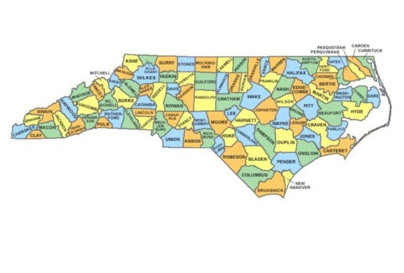
North Carolina County Map
North Carolina, the 12th state to join the Union, is a diverse and vibrant state with a rich history and culture. Located in the southeastern United States, North Carolina is known for its beautiful beaches, majestic mountains, and charming cities.

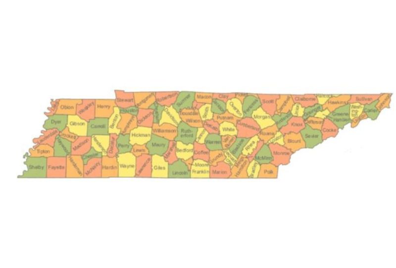
Tennessee County Map
Tennessee, the “Volunteer State,” is one of the most diverse states in the United States, with a rich history and culture. Located in the southeastern region of the country, Tennessee is bordered by Kentucky to the north, Virginia to the east
All County Maps
Blank Map of Vermont Counties | Printable Vermont Map
Blank Map of Vermont - Vermont, located in the north eastern part of the United States, is famous for its scenic beauty, splendorous autumn colors, and close-knit communities. It is in the New England region, sharing its borders with Massachusetts to its south, New...
Blank Map of Utah Counties | Printable Utah Map
Blank Map of Utah - The western United States has a state with Utah, various landscapes, rich cultural heritage and a close meaning of the community. The state shares boundaries with Kolorado in the east, Vyoming in the north -east, Idaho in the north, Nevada in the...
Blank Map of Virginia Counties | Printable Virginia Map
An outline map of Virginia with counties is a meaningful product with several functions, providing significant benefits in a variety of teaching, business and personal abilities. To teach its value, can be considered as lying for the use of plan, in, and beyond the...
Blank Map of Texas Counties | Printable Texas Map
A Blank map of Texas is a highly detailed map that provides an elaborate list of information, including different geography, infrastructure, and demographic distribution aspects of the state. Blank Map of Texas PDF Geographic Features Major Cities: Houston: The Texas...
Blank Map of Wyoming Counties | Printable Wyoming Map
An empty map of vyoming is an effective educational and practical resource that can be employed in a crowd of references, from classroom learning to professional use. The empty map of Vyoming is an extremely versatile tool that can complete the wider scope of tasks in...
Blank Map of Wisconsin Counties | Printable Wisconsin Map
Wisconsin County Map Blanc is a useful tool with extensive applications in various educational, professional and individual uses. Within the education sector, it is a useful tool for geography teaching, where students can learn about the political boundaries of the...
