Iowa County Map : Iowa is situated in the center of the Corn Belt and is a top corn, soybean, and pork-producing state in the United States. The state’s fertile plains and rolling hills make it the perfect location for farming. Iowa is also a hub for a variety of food processing businesses, which make it a top destination for the food industry.
Related Post –
- Kentucky County Map
- Arizona County Map
- North Carolina County Map
- Tennessee County Map
- Illinois County Map
- Pennsylvania County Map
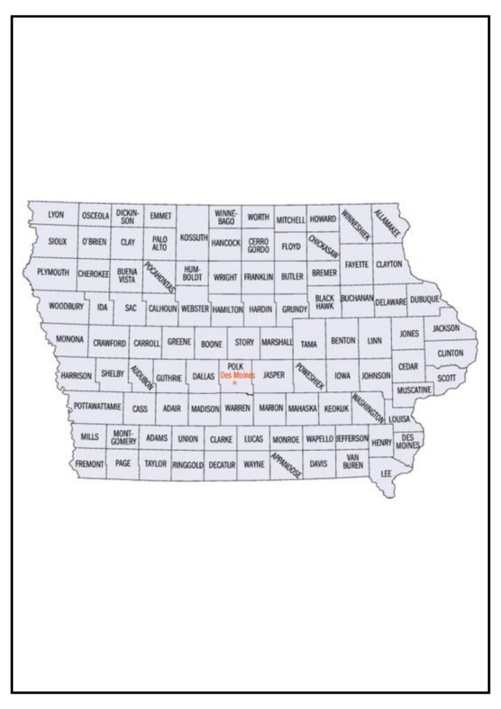
Iowa County Map

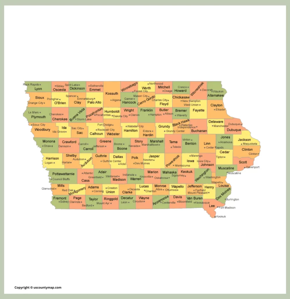
Iowa is a Midwestern state in the United States with a rich agrarian past and gorgeous landscapes. The state is divided into 99 counties, each of which has its own distinct identity and attractions.
The Iowa County Map is an important resource for traversing the state’s varied geography and culture. It indicates the position of all 99 counties and their chief cities and towns. It also contains data on key highways, rivers, and lakes.
Below is a brief description of some of the most significant counties on the Iowa County Map:
- Polk County: Polk County is Iowa’s most populated county and home to the state capital, Des Moines. Des Moines is a successful city with a robust economy and an active arts and culture scene.
- Linn County: Linn County is Iowa’s second most populated county and home to the city of Cedar Rapids. Cedar Rapids is a prominent manufacturing and agricultural center.
- Scott County: Scott County is the state’s third most populated county and contains the city of Davenport. Davenport sits on the Mississippi River and is a prime transportation and manufacturing center.
- Johnson County: Johnson County is the fourth most heavily populated county in Iowa and is located in the city of Iowa City. The city of Iowa City has the University of Iowa located there, and it is a leading hub for education and research.
- Woodbury County: Woodbury County is Iowa’s fifth most populated county and is where the city of Sioux City is located. Sioux City sits on the Missouri River and is a prominent agricultural and manufacturing center.
City and County Map of Iowa
The map also contains data on major highways, rivers, and lakes.
Iowa’s largest cities are:
- Des Moines
- Cedar Rapids
- Davenport
- Iowa City
- Sioux City
These cities have a range of amenities and attractions, such as museums, art galleries, theatres, restaurants, and shops.
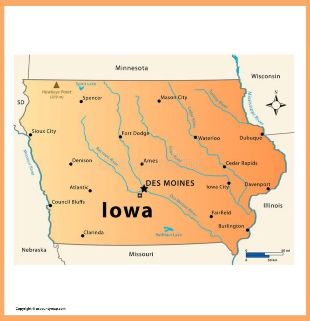
Other notable cities in Iowa include:
- Ames
- Burlington
- Council Bluffs
- Dubuque
- Fort Dodge
- Mason City
- Waterloo
- West Des Moines
The map is also of great use for businesses and organizations. For instance, companies can utilize the map to determine areas of potential market and customers. Organizations can utilize the map to determine areas of potential partners and collaborators.
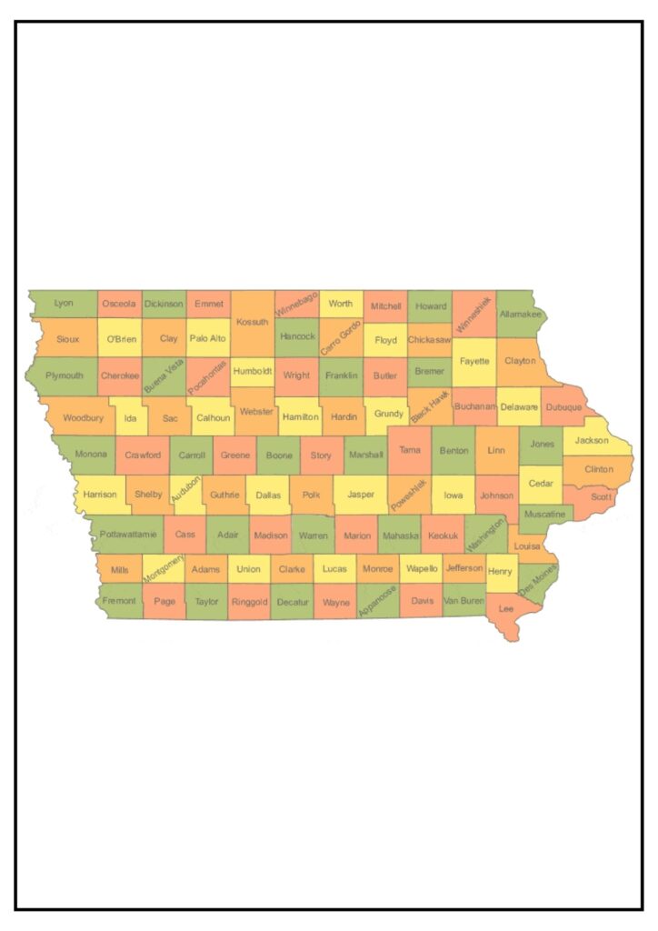
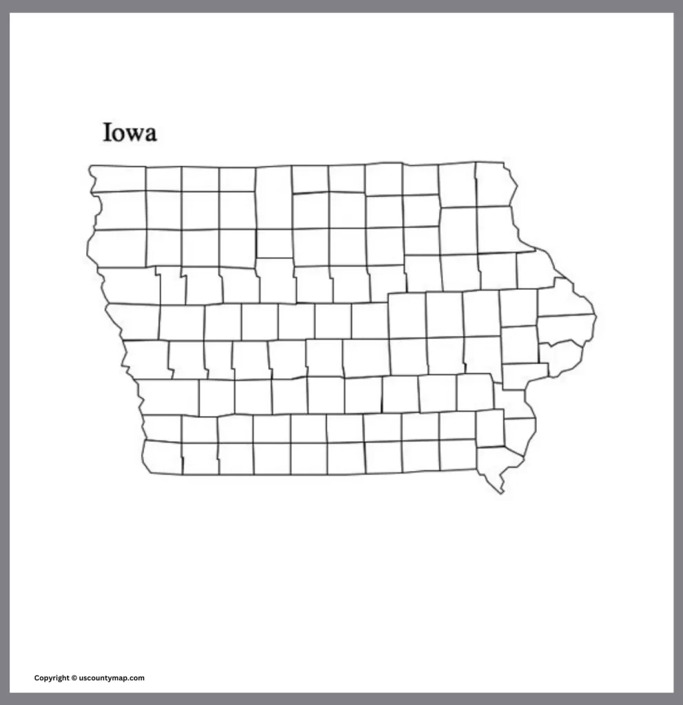
State of IA Map with Counties
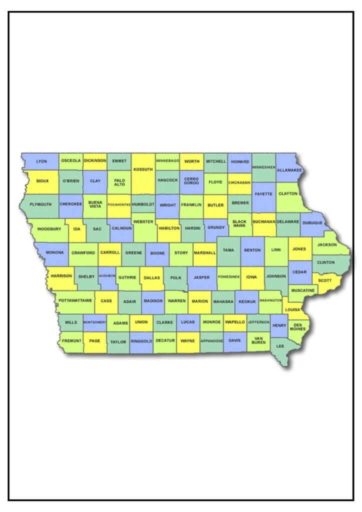
The State Map with Counties is a useful tool for investigating the state’s varied geography and culture.
The State of Iowa Map with Counties may be used for a range of purposes, including:
- Planning a road trip
- Finding a new place to call home
- Learning more about the geography and culture of the state
- Finding particular attractions, including museums, parks, and historic sites
- Identifying potential markets and customers (for businesses)
- Identifying potential partners and collaborators (for organizations)
If you are searching for a wonderful place to live, work, and bring up a family, Iowa is an excellent choice. The state has something for everyone, ranging from its lovely landscapes to its robust economy.
Taylor County Iowa Map
Taylor County is a county in the state of Iowa, USA. It’s in the southwestern corner of the state and is characterized by rural scenery and small-town life. Taylor County is bordered by Adams County to the north, Ringgold County to the east, Page County to the southeast, Nodaway County in Missouri to the south, and Adams County in Missouri to the west.
Bedford is the county seat of Taylor County and also the largest town in the county. Other towns in the county are Gravity, Lenox, and Sharpsburg, among others.
Geographically, Taylor County is mostly composed of rolling hills and agricultural land use. The economy of the county is based mostly on agriculture, with farming being the primary industry. The primary products grown are corn, soybeans, and livestock.
When it comes to the details of the Taylor County map, it would usually have the following information:
- Roads and Highways: The map would include major roads, highways, and minor roads linking different towns and communities in the county.
- Cities and Towns: The map would show the positions of cities, towns, and villages in Taylor County, including the county seat of Bedford and other smaller towns.
- Natural Features: Significant natural features like rivers, creeks, lakes, and forests could be shown on the map, giving an idea of the natural landscape of the county.
- Boundaries: The map would define the boundaries of Taylor County, marking it from surrounding counties in Iowa and Missouri.
- Landmarks and Points of Interest: Major landmarks, points of interest, and facilities like schools, parks, government offices, and historical monuments can also be marked on the map.

A Taylor County map is a useful tool for residents, tourists, and businesses alike, offering geographical data and facilitating navigation in the region.