Michigan County Map – Michigan is a Midwestern state in the Great Lakes region of the United States. It is the 11th most populous state in the United States, with more than 10 million inhabitants. It is famous for its numerous lakes and rivers, and its forests and agricultural land. The state also has several large cities, including Detroit, Grand Rapids, and Ann Arbor.
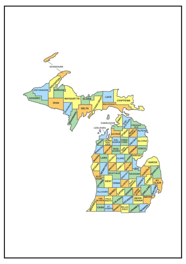
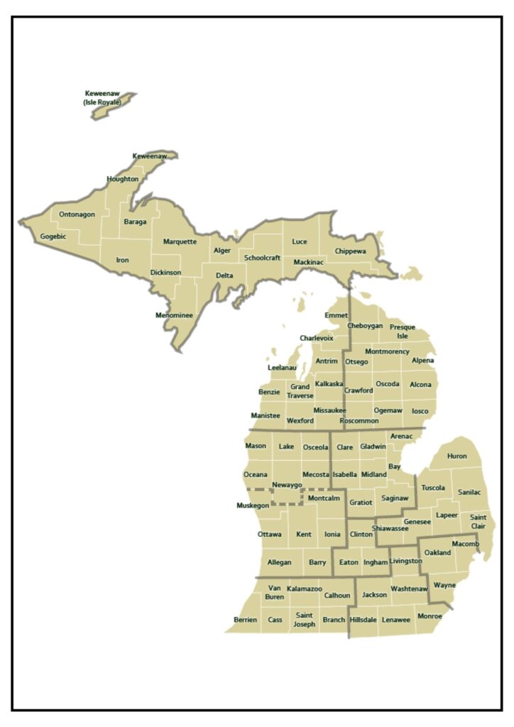
Michigan County Map
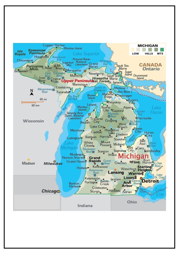
Michigan also has diverse agricultural areas. The Thumb area is the biggest agricultural area of the state and is famous for producing sugar beets, beans, and corn. The Fruit Belt area is also a prominent agricultural area and is famous for the production of apples, cherries, and peaches.
The Michigan county map can be a helpful tool for learning about the state’s geography, diversity, and economy. It can be used to plan travel, learn about new locations, and discover all that Michigan has to offer.
Below are some of the most visited Michigan counties, along with a brief overview of each:
- Wayne County: The most populous county in Michigan is Wayne County, which boasts the city of Detroit. It is also where numerous attractions are found, including the Detroit Institute of Arts, the Henry Ford Museum of American Innovation, and the GM Renaissance Center.
- Oakland County: Oakland County is the second most populated county in Michigan and is home to the city of Pontiac. It also has a diverse range of attractions, including the Detroit Zoo, the Cranbrook Educational Community, and the Meadow Brook Hall mansion.
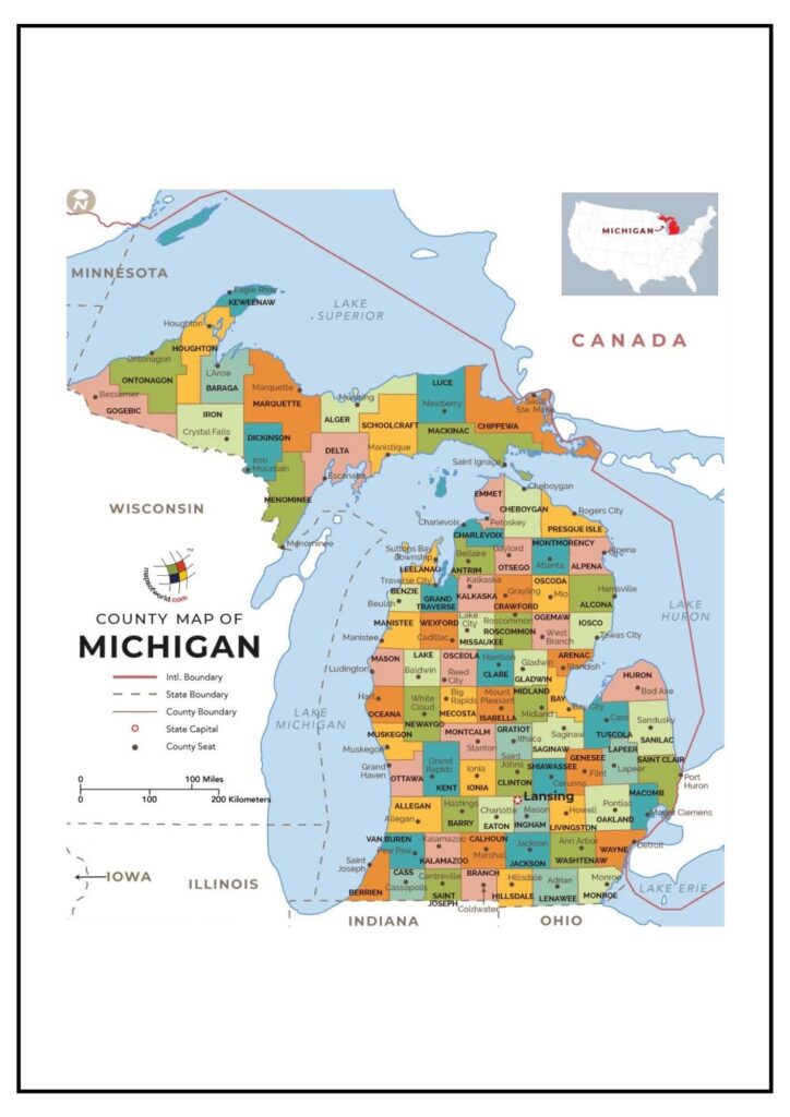
Michigan County Map with Cities
There are 83 counties in Michigan, more than in any other state in the US. They are located on two peninsulas, the Upper Peninsula and the Lower Peninsula. The Lower Peninsula is industrialized and has a larger population compared to the Upper Peninsula, which is more rural and has few people.
The Michigan county map with cities indicates the boundary of each county, and the position of the county seat, which is the administrative center of the county. The map also indicates the position of major cities and towns in every county.
Some of the major cities and towns in Michigan, and their respective counties, are as follows:
Lower Peninsula:
- Detroit, Wayne County
- Grand Rapids, Kent County
- Ann Arbor, Washtenaw County
- Flint, Genesee County
- Lansing, Ingham County
- Saginaw, Saginaw County
- Warren, Macomb County
Upper Peninsula:
- Marquette, Marquette County
- Escanaba, Delta County
- Sault Ste. Marie, Chippewa County
- Ironwood, Gogebic County
- Houghton, Houghton County
The Michigan map of counties with cities is an effective resource for anyone interested in learning more about the geography, history, and culture of the state.
Oakland County Map Michigan
Oakland County is a county in the eastern portion of the Lower Peninsula of Michigan. It shares boundaries with Wayne County to the south, Macomb County to the west, Livingston County to the north, and Washtenaw County to the east. Its county seat is Pontiac.
Oakland County is the state’s second most populated county, with more than 1.2 million residents. Oakland County is a leading hub for business, industry, and education. It is home to several Fortune 500 companies such as General Motors, Ford Motor Company, and Quicken Loans. Oakland County also hosts Oakland University, which is one of the largest universities in Michigan.
The Oakland County map indicates the boundaries of the county, the major cities, and towns. The map indicates the position of the major highways and roads too.
Some of the major towns and cities of Oakland County along with their populations are as follows:
- Pontiac (67,000)
- Bloomfield Hills (34,000)
- Royal Oak (59,000)
- Ferndale (21,000)
- Farmington Hills (77,000)
- Oak Park (28,000)
Wayne County Map Michigan
Wayne County is a county in the southeastern region of the Lower Peninsula of Michigan. It is bounded by Oakland County to the north, Macomb County to the west, Monroe County to the south, and Lake Erie to the east. Its county seat is Detroit.
Wayne County is the most populated county in Michigan, with a population of more than 2.8 million. It is a leading business, industrial, and transportation hub. The county hosts the Detroit metropolitan area, which is the largest metropolitan area in Michigan and the 14th largest metropolitan area in the United States.
Some of the leading cities and towns in Wayne County, as well as their respective populations, are as follows:
- Detroit (672,632)
- Warren (134,280)
- Flint Township (149,687)
- Livonia (103,462)
- Troy (85,002)
- Pontiac (67,116)
Michigan is inhabited by individuals from across the globe, and it is this diversity that is mirrored in its culture. Michigan is a dominant hub of manufacture, farming, and tourism.
Counties in Michigan Map
Below is the list of counties in Michigan:
- Alcona
- Alger
- Allegan
- Alpena
- Antrim
- Arenac
- Baraga
- Barry
- Bay
- Benzie
- Berrien
- Branch
- Calhoun
- Cass
- Charlevoix
- Cheboygan
- Chippewa
- Clare
- Clinton
- Crawford
- Delta
- Dickinson
- Eaton
- Emmet
- Genesee
- Gladwin
- Gogebic
- Grand Traverse
- Gratiot
- Hillsdale
- Houghton
- Huron
- Ingham
- Ionia
- Iosco
- Iron
- Isabella
- Jackson
- Kalamazoo
- Kalkaska
- Kent
- Keweenaw
- Lake
- Lapeer
- Leelanau
- Lenawee
- Livingston
- Luce
- Mackinac
- Macomb
- Manistee
- Marquette
- Mason
- Mecosta
- Menominee
- Midland
- Missaukee
- Monroe
- Montcalm
- Montmorency
- Muskegon
- Newaygo
- Oakland
- Oceana
- Ogemaw
- Ontonagon
- Osceola
- Oscoda
- Otsego
- Ottawa
- Presque Isle
- Roscommon
- Saginaw
- St. Clair
- St. Joseph
- Sanilac
- Schoolcraft
- Shiawassee
- Tuscola
- Van Buren
- Washtenaw
- Wayne
- Wexford