Pennsylvania County Map :Pennsylvania, the Keystone State, is a dynamic and diverse state rich in history and culture. It is situated in the Mid-Atlantic states in the United States of America, sharing borders with New York in the north, New Jersey in the east, and Delaware and Maryland to the south.
Related Post –
Pennsylvania County Map
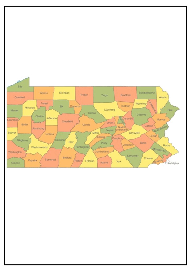
It is a map that indicates the various counties within the state of Pennsylvania. There are 67 counties in the state of Pennsylvania. The counties are the major local government units in the state. The counties are in charge of offering various services to their citizens, such as public safety, education, and roads.
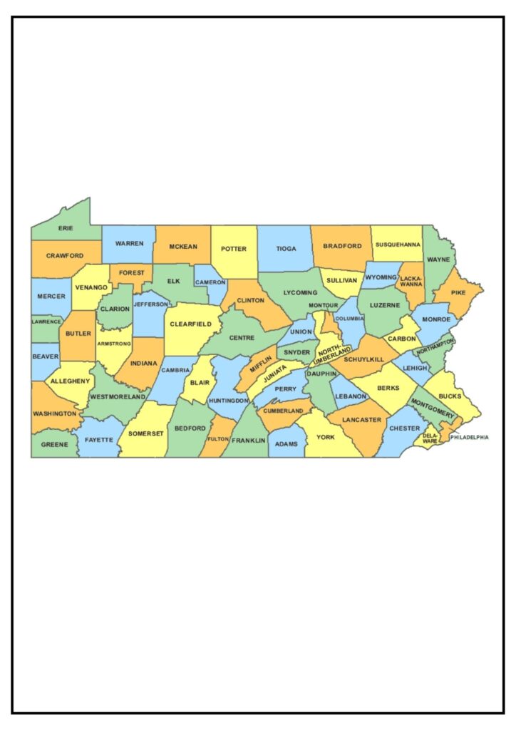
The maps of Pennsylvania counties can be utilized for various purposes.
- Locate the position of various counties within the state.
- Learn about various counties in the state, for instance, population, size, and geography.
- Determine which county a given city or town falls in.
- Decide the boundary of various counties.
- Plot routes of traveling from one county to another.
Pennsylvania county maps are available in many different formats, such as print, online, and mobile apps. Print maps are usually available at government agencies, libraries, and bookstores. Online maps are available on many websites, including the US Census Bureau website and the Pennsylvania Department of Geographic Information Systems website. Mobile apps are available to download from app stores like the Apple App Store and the Google Play Store.
Map of Pennsylvania Counties with Cities
The Map of Pennsylvania Counties with Cities indicates the state of Pennsylvania’s 67 counties and the key cities in each county. Philadelphia is the biggest city in Pennsylvania and also serves as the county seat of Philadelphia County. Pittsburgh (Allegheny County), Allentown (Lehigh County), Erie (Erie County), and Reading (Berks County) are other key cities in Pennsylvania.
Below is a general rundown of some of the larger Pennsylvania cities:
- Philadelphia: Philadelphia is the most populous city in Pennsylvania and the sixth-most populous city in the United States. Philadelphia is a historic city that has a deep cultural heritage. The city houses several world-renowned museums, such as the Philadelphia Museum of Art and the Franklin Institute. Philadelphia also has several professional sporting teams, including the Philadelphia Eagles (NFL), the Philadelphia Phillies (MLB), and the Philadelphia 76ers (NBA).
- Pittsburgh: Pittsburgh is one of the principal industrial cities which has redefined itself as a hub for innovation and technology. Pittsburgh also contains several professional sporting teams, among them the Pittsburgh Steelers (NFL), the Pittsburgh Pirates (MLB), and the Pittsburgh Penguins (NHL).
- Allentown: Allentown is a city located in eastern Pennsylvania with a reputation for its Moravian heritage. The city has a number of historic sites, including the Moravian Museum of Bethlehem and the Old Zion Reformed Church. Allentown is also the home of a number of Fortune 500 firms, such as Air Products & Chemicals, Inc. and PPL Corporation.
Map of Chester County Pennsylvania [Pennsylvania Counties Map]
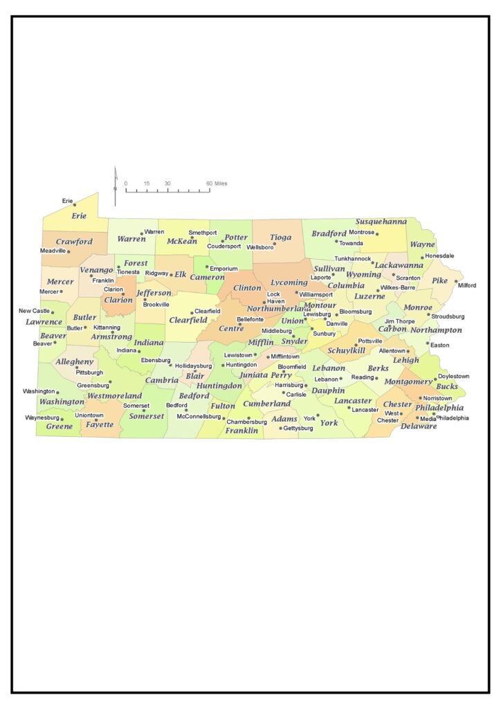
Chester County is a county in the southeastern region of the state of Pennsylvania. The county has Montgomery County to the northeast, Delaware County to the east, New Castle County, Delaware to the south, Lancaster County to the west, and Berks County to the northwest. Chester County is the seventh most populous county in Pennsylvania with a population of more than 534,000 individuals.
Below is a concise summary of some of the prominent municipalities in Chester County:
- West Chester: West Chester is the largest municipality in Chester County and the county seat. West Chester is a lively town with a rich arts and culture scene. The town boasts a number of colleges and universities, such as West Chester University of Pennsylvania and Cheyney University of Pennsylvania.
- Downingtown: Downingtown is a Chester County borough that features a historic downtown area and is family-oriented. Downingtown houses various businesses and industries, and a number of parks and recreation centers.
Pennsylvania has something for everyone. Whether you want to see history, culture, nature, or sports, it can be found in Pennsylvania.
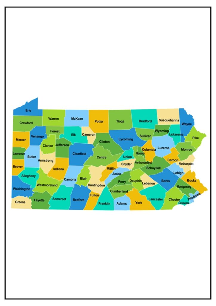
PA County Population Map [Pennsylvania County Map]
A detailed population Pennsylvania County Map (PA) counties would provide an overall visual depiction of the population distribution within the state.
- County Boundaries: The map would clearly delineate the boundary of each county in Pennsylvania from one another. This assists the viewer in determining the exact areas being examined and comprehending their spatial relationship.
- Population Density: Various coloring or shading methods would be employed to represent population density throughout the state. Regions having more concentrated populations, i.e., urban areas like Philadelphia, Pittsburgh, and the surrounding suburbs, would be darker or more colored, with rural areas being light or less colored.
- Population Clusters: Large population clusters in each county would be marked, generally with large symbols or labels. These might be cities, towns, and other areas of urban concentration where large groups of people live.
- Numeric Information: Numeric information overlays, such as population numbers or population density numbers, for each county could be included on the map. This enables observers to view accurate population numbers and compare areas within the state.
- Legend and Scale: A legend would be attached to the map, describing the color scheme or shading employed for population density as well as for any other symbols or data points represented. The scale would further show the level of detail and accuracy of representation of the map.
- Demographic Analysis: Depending on the complexity of the Pennsylvania County Map, it may also involve demographic breakdowns in addition to total population figures. This may involve data on age distribution, racial and ethnic makeup, or other applicable demographic variables.
- Time Period: The map can indicate the time period for which the population data is valid. Population numbers can fluctuate over time because of migration, births, and deaths, so indicating the reference year or period is crucial for putting the information into context.
In general, a comprehensive population map of Pennsylvania counties would offer significant insights into the concentration and distribution of individuals throughout the state, enabling policymakers, researchers, and others to grasp patterns of urbanization, demographic trends, and social dynamics in Pennsylvania’s communities.