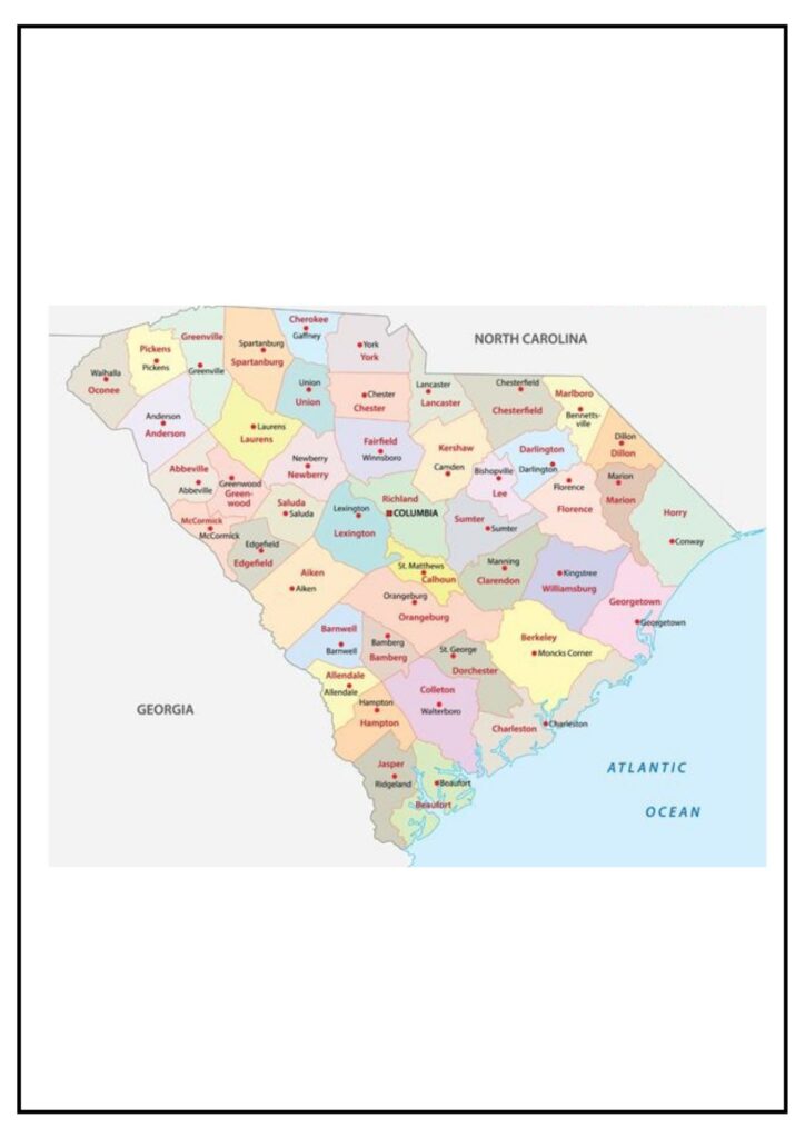
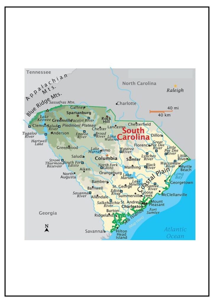
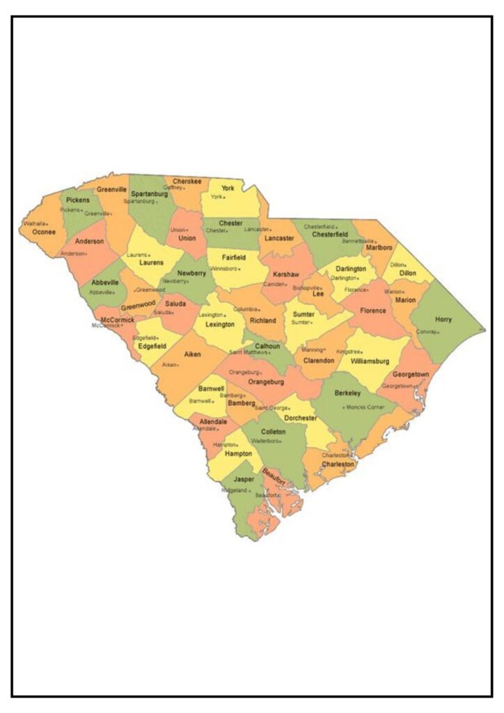
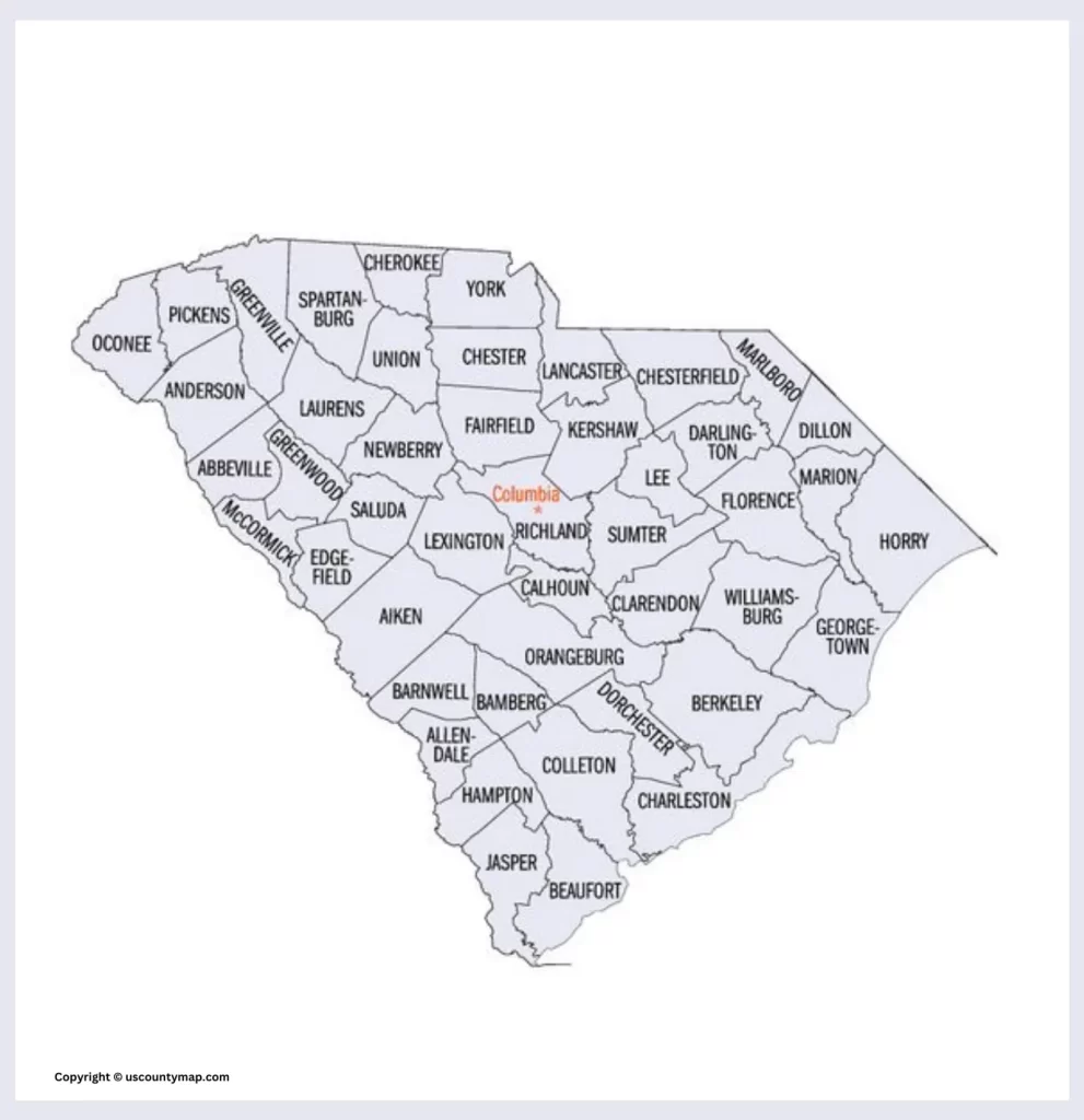
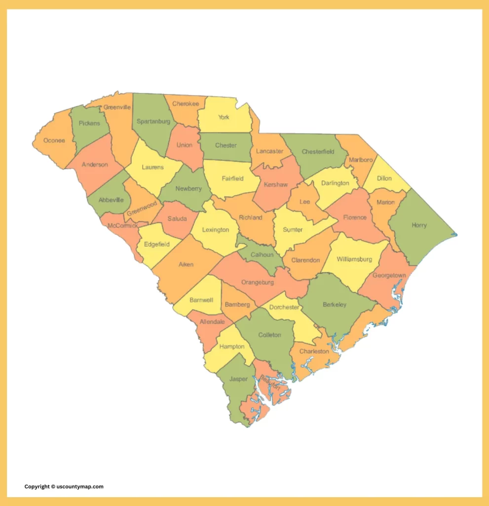
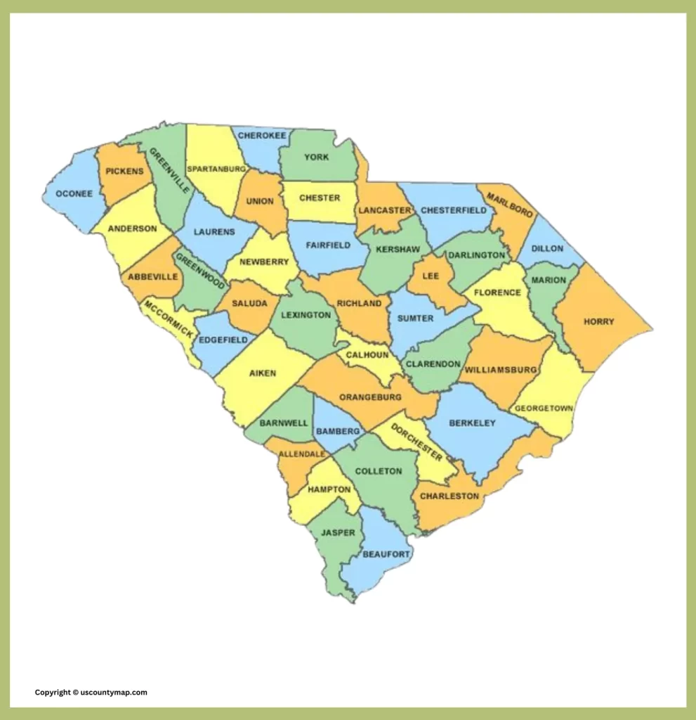
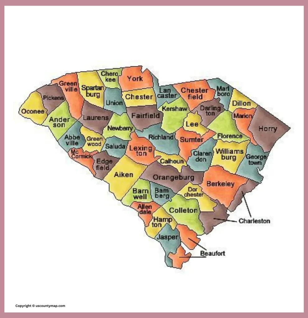
South Carolina County Map: South Carolina, or the Palmetto State, is in the southeastern United States. It shares borders with North Carolina in the north, Georgia in the southwest, and the Atlantic Ocean in the southeast. It is the 40th largest state by land and the 26th most populous state in the country. Its capital is Columbia.
The history of South Carolina goes way back to the beginning of the early 16th century when there was a landing of Spanish explorers in this region.SC was among the original thirteen colonies.
Related Post –
South Carolina County Map [SC County Map]
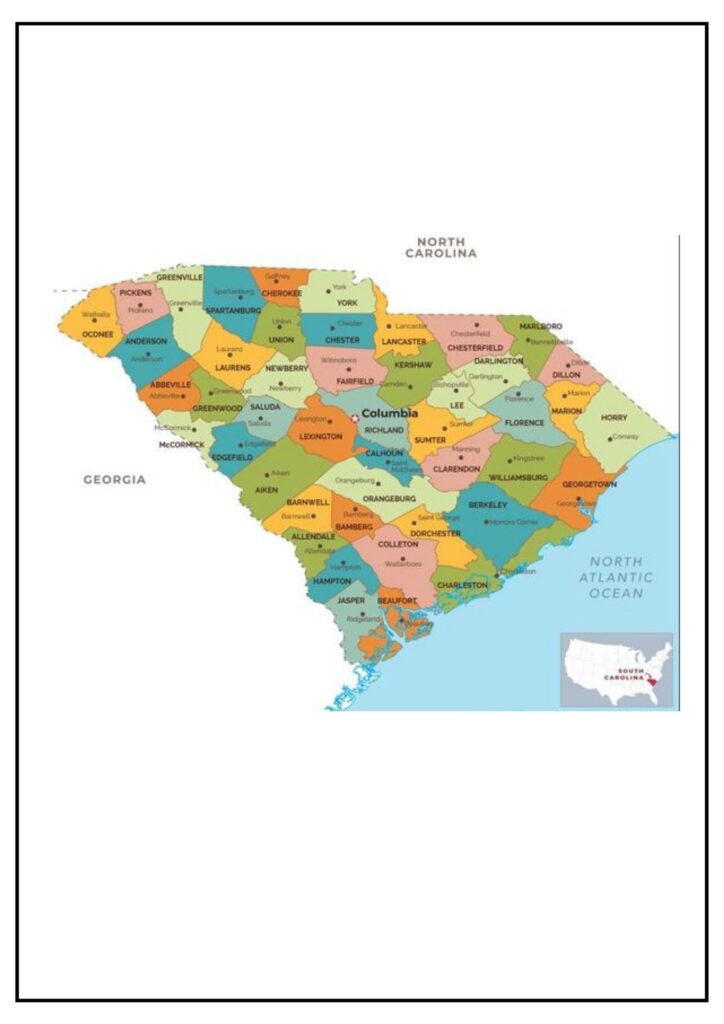
A South Carolina Map with Counties is a map that displays the state’s 46 counties. It indicates the borders of each county, along with the position of major cities and towns. County maps can be utilized for a number of purposes, including trip planning, locating businesses, and demographic research.
South Carolina counties are divided into five regions: the Lowcountry, the Midlands, the Pee Dee, the Upstate, and the Sandhills.
Some of the uses of a South Carolina county map include:
- Planning trips: A county map can be used to plan a trip to South Carolina. The map can indicate the best routes to use and the location of major attractions.
- Finding businesses: A county map can be used to locate businesses in South Carolina. The map can indicate the location of businesses in a specific county or region.
- Studying demographics: You can study demographics in South Carolina using a county map. The map will reveal the population density, income, and education level in each county.
County Map of South Carolina With Cities
The largest counties in South Carolina are Charleston County, Greenville County, Richland County, and Spartanburg County. These counties contain the large cities of Charleston, Greenville, Columbia, and Spartanburg.
A map of South Carolina counties with cities is a visual image of the state’s 46 counties and their principal cities and towns. It is a worthwhile tool for trip planning, business location searching, and demographics research.
Following is a list of some of South Carolina’s largest cities and their respective counties:
- Charleston County: Charleston, Mount Pleasant, North Charleston
- Greenville County: Greenville, Mauldin, Simpsonville
- Richland County: Columbia, Forest Acres, Irmo
- Spartanburg County: Spartanburg, Greer, Duncan
- Aiken County: Aiken, North Augusta, Edgefield
- Sumter County: Sumter, Turbeville, Dalzell
- Florence County: Florence, Darlington, Timmonsville
- Anderson County: Anderson, Easley, Piedmont
- Colleton County: Walterboro, Summerville, Moncks Corner
- Dorchester County: North Charleston, Summerville, Goose Creek
Hampton County South Carolina Map
Hampton County is a rural county in South Carolina’s Lowcountry region. It is bounded by Allendale County to the north, Colleton County to the east, Jasper County to the south, and Effingham County, Georgia, to the west. Hampton County is the 39th largest county by land area and the 44th most populated county in South Carolina. The county seat is Hampton.
A Hampton County South Carolina map indicates the boundaries of the county, as well as the position of its largest cities and towns, such as Hampton, Varnville, Brunson, Estill, and Yemassee. The map also indicates the county’s major highways, rivers, and lakes.
Below is a list of some of the cities and towns in Hampton County, as well as their populations (as per the 2020 census):
- Hampton (2,241)
- Varnville (1,996)
- Brunson (552)
- Estill (2,181)
- Yemassee (1,070)
If you need a state that has a great history, great beaches, great food, and nice people, then you should be looking at South Carolina. A South Carolina county map gives a visual image of the administrative regions of the state, showcasing its 46 counties.
Major Features of the South Carolina County Map
- County Boundaries:
- Unambiguous Borders: All the 46 counties have well-defined borders with clear boundaries to indicate the demarcation between various administrative areas.
- Labels: Counties are often marked with names for easy identification.
- Major Cities and Towns:
- County Seats: The county seat (county administrative center), typically an important town or city, is commonly marked on the map.
- Other Key Cities: Principal cities like the state capital, Columbia, Charleston, Greenville, and Myrtle Beach are commonly picked out.
- Highways and Roads:
- Interstate Highways: Significant highways like I-26, I-20, I-77, and I-95 are shown, illustrating connectivity between counties.
- State Routes: Key state routes and highways are indicated to offer a complete transportation network.
- Natural Features:
- Rivers and Lakes: Major rivers like the Savannah River, Santee River, and Pee Dee River are indicated, as well as major lakes such as Lake Marion and Lake Moultrie.
- Mountain Ranges: In the northwest, the map might feature sections of the Blue Ridge Mountains.
- Rivers and Lakes: Major rivers like the Savannah River, Santee River, and Pee Dee River are indicated, as well as major lakes such as Lake Marion and Lake Moultrie.
- Geographic Regions:
- Upstate: The northwestern region of the state, famous for its mountains and foothills.
- Midlands: The middle region, home to the state capital, Columbia.
- Pee Dee: The northeast region, named for the Pee Dee River.
- Lowcountry: The coastal area, where one can find marshes, beaches, and old cities such as Charleston.
- Points of Interest:
- Historical Sites: Sites of historic interest, such as Fort Sumter, which saw the initial shots of the Civil War.
- Tourist Attractions: Tourist spots such as Myrtle Beach, Hilton Head Island, and Congaree National Park.
Applications of the South Carolina County Map
- Educational Tool:
- Geography Instructions: Educates pupils about the state geography, e.g., where the counties, large towns, and topographic features are located.
- History Studies: Aids in studying the history of South Carolina, the meaning and implications of several districts and historical monuments.
- Government and Administration:
- Planning and Zoning: Use of urban planning, zoning and resource allocation is used by the state and local government officials.
- Political campaign: Helps to organize political campaigns and formulate strategies, understanding demographics and district.
- Travel and Tourism:
- Tourist Guide: Travels are involved in a brochure and guide to help tourists navigate the state and find out attractions.
- Road trips: Useful for planning road trips, showing major highways, and points of interest.
- Tourist Guide: Travels are involved in a brochure and guide to help tourists navigate the state and find out attractions.
- Business and Marketing:
- Market Analysis: Businesses use maps for market analysis, identify potential areas for expansion based on county
- Services sector: Helps businesses define service sectors and distribution sectors.
- Emergency Services:
- Disaster Management: Crucial for planning and coordinating emergency response and disaster management operations.
- Resource Distribution: Utilized for planning the allocation of resources during emergencies such as hurricanes or flooding.
- Real Estate:
- Property Listings: Real estate agents utilize the map to show property locations and offer background information about the area around the properties.
- Area Analysis: Buyers are able to compare various counties on the basis of amenities, schools, and other criteria.
General Information about South Carolina
- Where it is: South Carolina is situated in the southeastern part of the United States, bordered by North Carolina in the north, Georgia in the south and west, and the Atlantic Ocean to the east.
- Capital: Columbia.
- Population: Around 5 million inhabitants.
- Economy: Major industries are manufacturing, agriculture, tourism, and healthcare.
- Climate: Humid subtropical climate with hot summers and mild winters.
In short, a South Carolina county map is an adaptable resource that fulfills multiple educational, administrative, and functional purposes, providing detailed information on the state’s geography, demographics, and infrastructure

