West Virginia County Map :West Virginia, or the Mountain State, is a stunning and varied state in the Appalachian Mountains. West Virginia has a rich and interesting history. It was the only state to secede from the Confederacy during the Civil War, and it has had a significant role in American industry and culture. The state boasts an assortment of historical landmarks, including the New River Gorge Bridge, the Harpers Ferry National Historical Park, and the Hatfield-McCoy Trail.
Related Post –
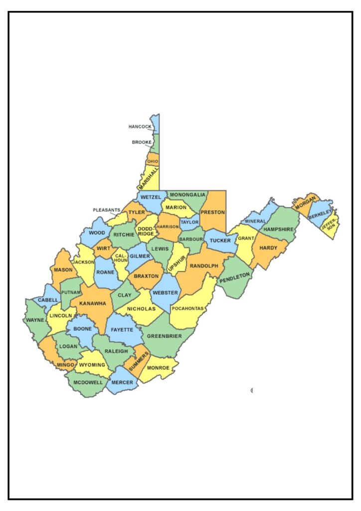
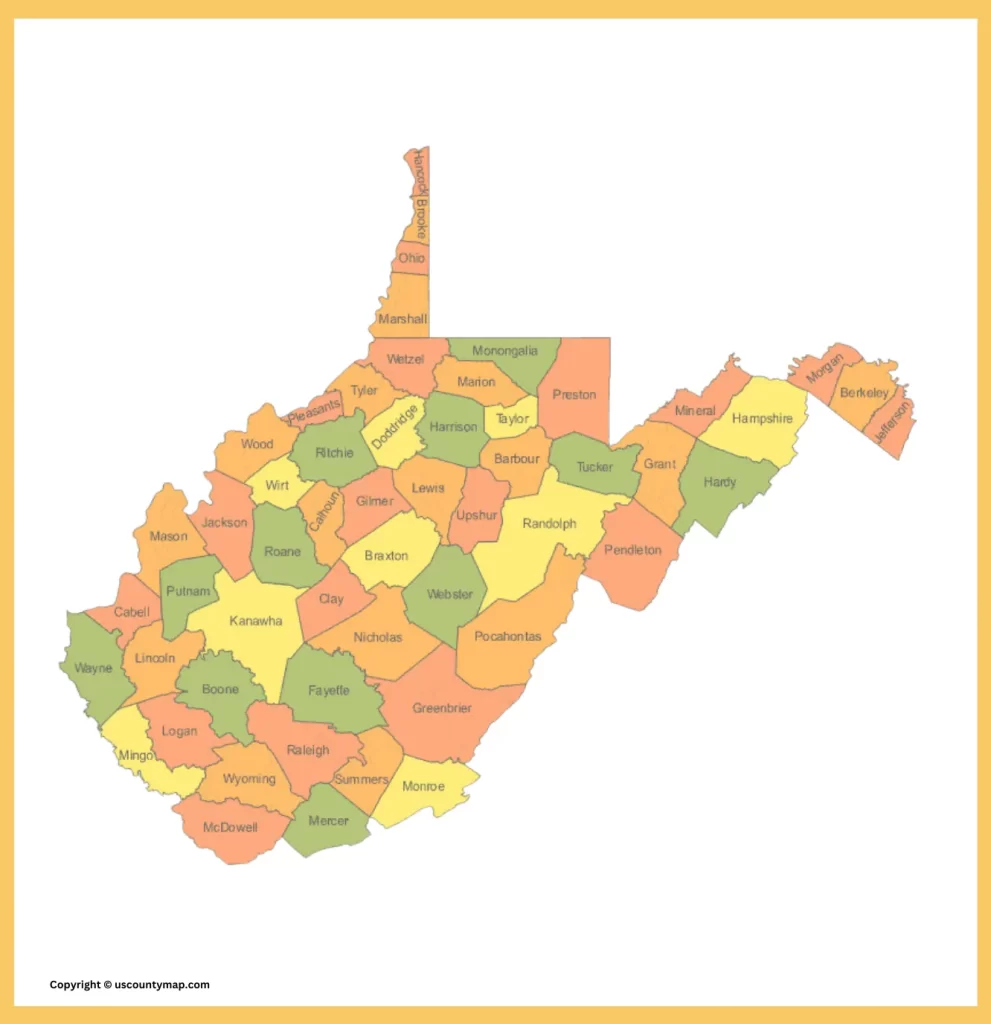
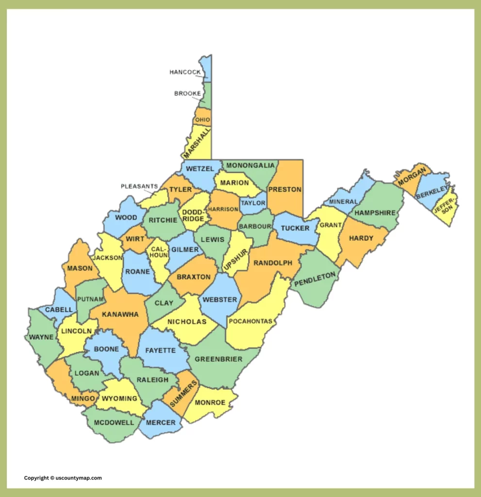
West Virginia County Map [WV County Map]

The County Map is a visual map of the state’s 55 counties. The map indicates the size and position of each county, along with the major towns and cities. The map can be used to learn more about the geography, history, and culture of the state.

The map indicates that West Virginia is a comparatively small state, yet it contains a high number of counties. This is because the state has mountainous geography, which made it hard to move and communicate between sections of the state in the early years.
Some of the uses of the West Virginia County Map include:
- To know about the geography of the state, e.g., where its mountains, rivers, and major cities are.
- To know about the history of the state, e.g., where its significant historical sites and battlefields are.
- Learn about the culture of the state, e.g., where various ethnic and religious groups are located.
- To prepare for a trip to West Virginia, e.g., by determining the whereabouts of state parks, national forests, and other places of interest.
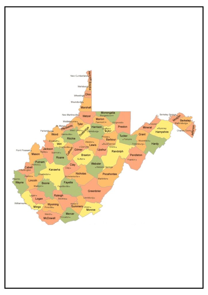
Map of West Virginia with Counties and Cities [West Virginia County Map]
West Virginia is a state rich in history and culture, and its cities are no exception. From the state capital of Charleston to the college town of Morgantown, there is a city in West Virginia for every interest.
Below is a brief description of some of the largest cities in West Virginia:
- Charleston: Charleston is the capital of the state and the largest city in West Virginia. Charleston is home to the West Virginia State Capitol, the Clay Center for the Arts and Sciences, and the Charleston Coliseum and Convention Center. Charleston is also a significant hub for business and industry.
- Morgantown: Morgantown is situated in Monongalia County, and it is the site of West Virginia University. Morgantown is an active college town with a rich arts and culture environment. The city also has a variety of businesses and industries, such as technology and healthcare.
- Huntington: Huntington is found in Cabell County, and it is also home to Marshall University. It is a chief business and industrial center, as well as hosting several cultural centers, such as the Huntington Museum of Art and the Camden Park amusement park.
Map of Boone County West Virginia [West Virginia County Map]
Boone County is a county within the U.S. state of West Virginia. Madison serves as its county seat.
Boone County is situated in the southern region of West Virginia, bordering the state of Kentucky to the south. The county has a diverse landscape, with mountains, valleys, and forests. Boone County also has several rivers and lakes, such as the Coal River, the Little Coal River, and Boone Lake.
The following are some of the things that make Boone County a unique place:
- Its natural attractions: Boone County has a wide range of landscape, from mountains and valleys to forests. The county also features various rivers and lakes, such as the Coal River, the Little Coal River, and Boone Lake.
- Its historical significance: Boone County features various historical attractions, such as the Boone County Courthouse, the Boone County Coal Museum, and the Boone County Veterans Memorial Park.
Importance
If you are seeking a lovely and varied place to reside, work, or vacation, West Virginia fits the bill. A West Virginia County Map is a valuable tool for a variety of reasons:
- Geographical Orientation: It gives a clear visual impression of the state’s geography, indicating the boundaries and names of all 55 counties. This assists residents and visitors in understanding the geographical divisions of the state.
- Navigation and Travel: The map facilitates travel route planning by indicating major cities, towns, roads, and highways. This is essential for anyone who has to navigate the state, either for business, tourism, or personal purposes.
- Administrative Use: The map is used by government administrators, planners, and agencies for administrative use. The map is helpful in regional planning and administration of regional policy, development initiatives, and allocation of resources.
- Emergency Services: Emergency personnel depend on county maps with detailed information to deliver effective services. Familiarity with the precise boundaries and important locations of each county is crucial to facilitate rapid response times.
- Educational Use: The map serves as an academic useful resource for college kids learning approximately the country’s geography, records, and nearby differences. It facilitates them visualize and better recognize the distribution of populace and resources.
- Economic Development: Companies utilize county maps to study market areas, develop logistics, and determine possible expansion sites. Knowledge of the geographic location of resources and infrastructure is crucial for economic planning.
- Historical and Cultural Significance: Most counties possess distinct historical and cultural identity. A county map assists in conserving and promoting this heritage by locating key landmarks, historic sites, and cultural areas.
A West Virginia County Map is an all-purpose and indispensable instrument for practical, educational, and administrative uses, serving to further understand and administer the state’s geographical and socio-economic terrain.